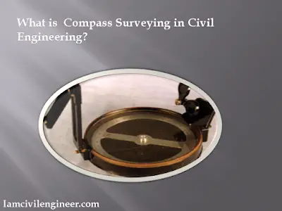
Compass surveying can be defined as the method of surveying in which the directions of the survey lines is determined by means of a compass and also by using tape or a chain. This measurement is directly done on the surface of the earth. The use of compass as a navigator is a practice followed for centuries. This was the only means through which directions and the horizontal measurements are made, before the invention of a theodolite or sextant.
 |
| What is Compass Surveying? |
Even after different findings in the field of surveying, this method of compass surveying is still used for preliminary measurements in engineering surveying. Most of the land surveying is conducted by compass surveying by the civil engineers and surveyors which helps the foresters, geologists etc.
Initially, the theodolites where equipped with a compass which made the same heavy. New theodolite does not have a compass in it.
Mainly the compass surveying method make use of a compass to carry out the angular measurements. The compass surveying procedure is done through traversing.
Magnetic Compass in Compass Surveying
The magnetic meridian is the basis on which the magnetic compass measures the directions. This will require the magnetized needle, a line of sight and a graduated circle. The important types of compass used in compass surveying are the:
- Prismatic Compass
- Surveyor’s Compass
- Transit compass
Principle of Magnetic Compass: The basic principle of working of a magnetic compass is that a magnetized steel or an iron that is suspended on a pivot at its center which lets it to oscillate freely about the vertical axis, will take the direction of the magnetic meridian of with respect to that place.
The basic parts of any magnetic compass used in surveying are the magnetic needle, Graduated ring, sighting vanes, reading system and a tripod to support the compass.
Principle of Compass Surveying
The main principle of compass surveying is traversing. Traverse, a series of connected lines is measures by a prismatic compass. Compass surveying is mainly employed in areas that is free from local attraction. This can be used for surveying the land area with undulations which is crowded and large.
Every bearing at each of station can be observed by conducting the compass survey by letting the needle to float. This approach is known as loose-needle or free surveying. But the same can be carried out with a compass with a Vernier fitted that is connected with the line of sight and moves over a fixed graduated circle. This method is called as fixed-needle or fast – needle surveying. The use of compass in compass surveying is found easy and portable which makes it suitable for exploratory surveys and reconnaissance. This bring a great application for the preliminary route surveys of lakes, streams, survey of rivers and for topographical works.
Traversing in Compass Survey
One of the main applications of compass surveying is traversing. Traverse can be defined as a series of connected straight lines each will join at two points on the ground. The length and directions of these lines are determined from the field measurements. Compass surveying is one of the widely practiced method to determine the relative locations of the points.
The traverse can be of two types:
Like Us on Facebook!
- Open Traverse
- Closed Traverse
Open Traverse: A traverse that never ends or returns to the starting point or the starting station or neither ends at a known station is called as an open traverse. The figure-2 below shows the pathway of an open traverse.
Subscribe Us on YouTube!
 |
| Fig.2. Open Traverse |
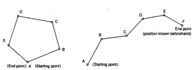 |
| Fig.3. (a) A closed traverse that is geometrically and mathematically closed (b) Closed traverse that is geometrically open but closed mathematically. |
Compass Traversing – Fieldwork
- Measurement of the Bearing of all the Survey Lines
- Measurement of length of all the lines using a tape or a chain
Fore Bearing and Back Bearing in Compass Surveying
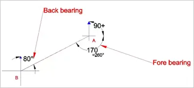 |
| Fig.4.The fore Bearing and Back bearing conducted on a line AB. |
Temporary Adjustments in Compass Survey – Using a Prismatic Compass
- Centering
- Levelling
- Focusing
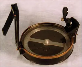 |
| Fig.5.Prismatic Compass |








Nice post. I learn something totally new and challenging on sites I stumbleupon on a daily basis. It's always useful to read content from other writers and practice a littyle something from their web sites.
Nice post. I learn something totally new and challenging on sites I stumbleupon on a daily basis. It's always useful to read content from other writers and practice a littyle something from their web sites.